In case you haven’t noticed yet, I’m a little bit neurotic – also crazy, but that’s not the focus of today’s story. So, when it came time to plan my hike on the Carters, my inner type A went into overdrive. Now, there are several ways to approach the Carters – out-and-back, loop, clockwise, counter-clockwise, hut, no hut, Mount Hight, no Mount Hight (that is NOT an option btw, but more on that later). I spent hours planning out this hike – pouring through trail guides, reading recent trail reports, consulting two of my (many) paper maps, and calculating the mileage for the different routes as if this was some sort of complex Good Will Hunting-esque equation.
I then held a state of the union call with my hiking partner (and fellow type A-er), Stef, to discuss our collective thoughts on which route we should take based off our research. And by collective, I mean convince her that my way is the best way – because I suffer from Only Child Syndrome (OCS). Stef – while not an only child, is a bit more intense about her physical activities than I am. While I often choose the path of least resistance, Stef will not shy away from a challenge and thrives off pushing her body to its limits. This is a quality about her I admire, as she has driven me to push my own boundaries (like last year, when she convinced Heidi and I to add on the entire Franconia Ridge traverse to our Flume/Liberty hike). But seeing as it was our first hike together of the season, I was not having any boundaries pushed for this hike. So, our state of the union call went something like this:
Stef: I was thinking we should grab Imp Face, it’s on the 52 WAV list..
Me: (consults map, sees that it adds 2 miles to the hike) NOPE!
Stef: Okay, but what about the hut?
Me: (remembers some story I read online about a guy dislocating his shoulder on the hike from the hut, so obviously that’s going to happen to us if we go there) NOPE! No hut!
Stef: (sighs) Fine. But will you drive then?
Me: (smiling triumphantly – OCS win) You’ve got a deal!
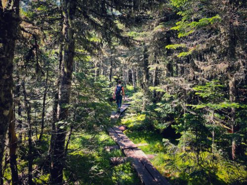
With our plans solidified, now came time for the actual hiking part. And as always, it made for an interesting adventure with highlights including Mount Hight and meeting White Mountains celebrity Floki, the adventure cat, and lowlights including Ball-Scratcher Dude, and Intense Woman With No Social Boundaries. But first, let’s talk about the approach:
The approach: Clockwise loop. Ascent on Imp Trail (via Camp Dodge cutoff), North Carter trail, Carter Moriah trail to Middle Carter, South Carter, Mount Hight and over to Carter Dome. For the descent, from Carter Dome we retraced our steps back to Carter Moriah trail, then onto Carter Dome trail, and Nineteen Mile Brook trail (NMB) for our final descent back to the parking lot.
Mileage: ~14 miles (including the road walk to Camp Dodge) | Elevation gain: ~4500 feet
Now let’s talk about parking, the road walk and how we got on Imp trail: we parked at the Nineteen Mile Brook (NMB) trailhead – technically we parked on the road, as the lot was completely full and overflowing by the time we arrived at 8:00am on a Saturday. From there, we walked .5 miles and turned right onto Camp Dodge Road. Once you get onto Camp Dodge Road, you’ll want to stay to the left. If you feel awkward, and you feel like you’re trespassing – you’re doing it right. You’ll enter Imp trail shortly after passing a bathhouse, with all sorts of bathhouse noises.
I cannot recommend the Camp Dodge cutoff enough. You get the road walk over with at the beginning, and the cutoff saves a mile of roadwalking and shaves off a mile from the Imp trail. Totally worth the awkward bad burrito scents and sounds coming from Dodge bathhouse.
Why I think it’s better to ascend clockwise via Imp trail: many people choose to ascend the Carters via NMB trail – and while that’s certainly a valid choice, only child here to tell you that my choice is better. Why? Imp trail is rocky and a bit rougher than NMB – and with all the rain we’ve been experiencing, it was quite wet and muddy at times. So, if you’re a person who would rather ascend that wet, rocky bullshit, then Imp is the trail for you.
But if you’re still not convinced, here’s a few more reasons why I think I’m right…
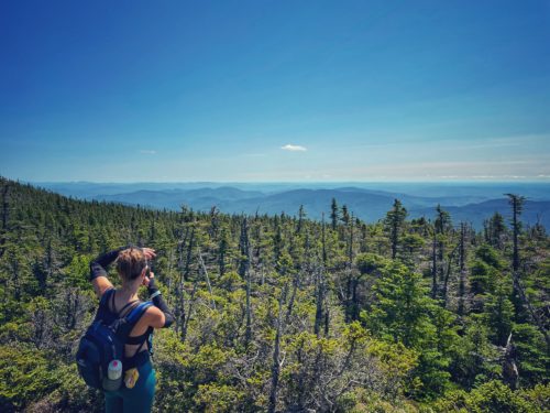
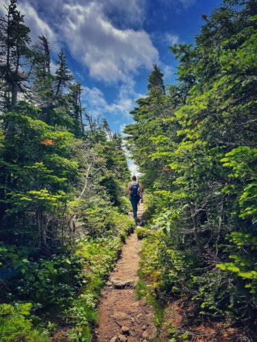
You get some nice ridgeline views early on. I’m going to be frank, hiking the Carters is a lot of walking in the woods – which is lovely and all, but at ~14-miles it can get a little monotonous at times. But by ascending Imp trail, we were rewarded with some early views of the Presidentials on the Carter Moriah trail (and a sneak peek to the magnificent views we would later get at Hight). In fact, the views were so distracting, that we completely walked by our first peak, Middle Carter – which as Stef so aptly put it: Total middle child syndrome mountain – poor, overlooked Middle Carter!
Now, let’s talk about Mount Hight. Public Service Announcement to my 48-seeking hiking friends – DO NOT SKIP THIS MOUNTAIN. I REPEAT, DO NOT SKIP THIS MOUNTAIN.
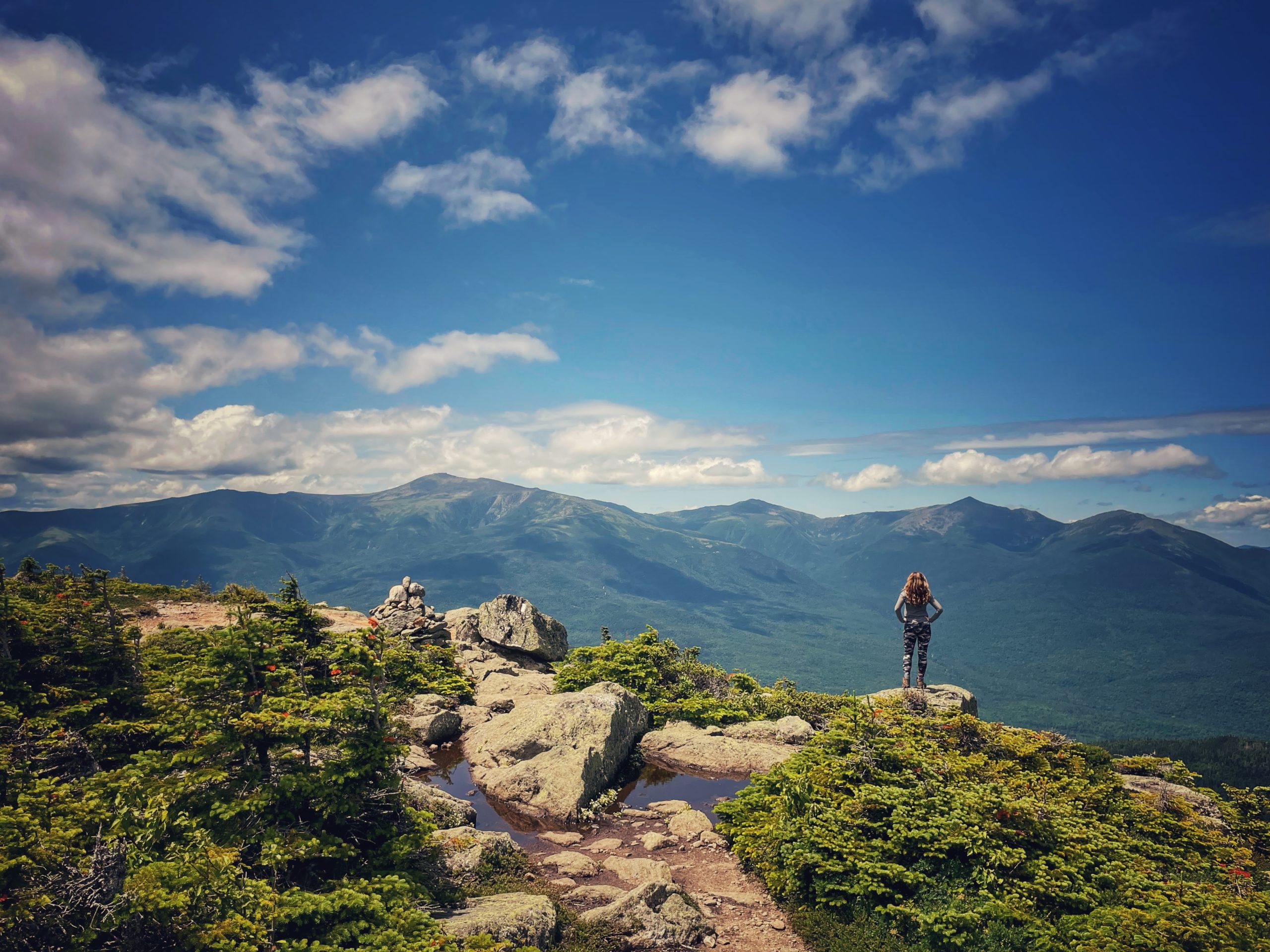
No, Mount Hight is not on the 4000 footer list (or any other list for that matter), but you will be sorry if you skip this magnificent mountain! The trail up Mount Hight is steep, eroded and rough – so again, if you like to ascend this type of thing (which I do), another reason why Imp trail is the way to go here. Once on top of Mount Hight, we were rewarded with some stunning views of the Northern Presidentials in all their magnificent glory – views that rival many of the other 4000 footer mountains. But many people skip over Mount Hight due to its lack of list status – DON’T BE ONE OF THOSE PEOPLE. GET OVER THE LIST – and frankly, get over yourself!
This brings me to one of the lowlights from Saturday’s hike: Intense Woman With No Social Boundaries.
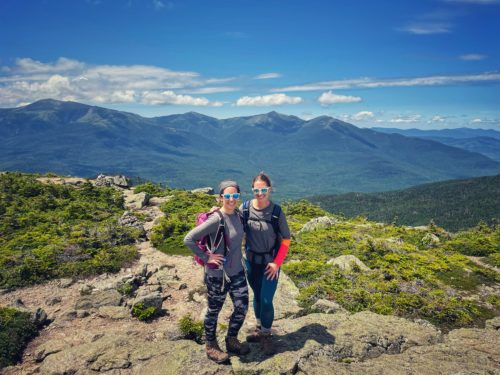
After eating a very large sandwich, I spent a good amount of time wandering around the Mount Hight summit taking photos and sighing dramatically at the epic views.
While I was gone, Intense Woman With No Social Boundaries (IWWNSB) stomped over to Stef, dropping her bag and sitting a little too close for comfort next to her. You know those people that just have no real sense of physical and/or social boundaries, and who really like to hear themselves talk? No, that’s not me (shut it, you!) – that is Intense Woman With No Social Boundaries (IWWNSB). And she was here on Mount Hight to remind us that the times of social distancing are OVER – as broken from my mountaintop reverie, I ran over to save my friend from IWWNSB’s intense energy and excessive yammering about her elderly mother, Bernice.
As we put on our packs, IWWNSB got offended, “YOU’RE NOT LEAVING BECAUSE OF ME, ARE YA!?!?!”
(well, yeah – kinda) But I didn’t know what to say, so like when Baby’s character in Dirty Dancing stammers about carrying a watermelon – all I could muster was, “I ate a really large sandwich!” – as if sandwich-eating is a barometer for how long one should spend on a mountain.

We scurried down Mount Hight and away from IWWNSB – the descent is easy peasy here (again +1 for the Imp approach). We then made our way to Carter Dome to bag our final peak – and to experience the second lowlight of our day – Ball Scratcher Dude (BSD). Now, if you follow my Instagram account (which you really should, pretty pretty please), you may have heard mention about BSD – but here’s the full story:
As we arrived at Carter Dome and walked toward the viewpoint, we were quickly stopped in our tracks by a dude loitering at the trail sign and itching his balls so aggressively, that I questioned whether or not this was a health or hygienic matter. BSD was not alone – and had a whole entourage of Bro Ball Dudes (BBD). While they did not seem to suffer from the same ball-scratching affliction as BSD, they were incredibly obnoxious and made access to the viewpoint impossible.
At this point, we decided to cut our losses, skip the view and head back down to Carter Dome trail. The BBD entourage also decided to do the same – loudly boasting to one another about how fast they ran the 400 meter in high school, and how they were going to, “Race down this fucking mountain, brahhhh!”
Stef and I pulled off to the side, waiting for a race that never happened, as they just continued to brag about themselves and compare dick sizes. It was then, I decided a little revenge was in order.
So, as they came upon us, I started clapping loudly and doing my best Coach Taylor from Friday Night Lights impression, I yelled at them, “I thought you were going to race down this fucking mountain!? ??? Track training starts in the Fall, let’s hustle boys, HUSTLE ??? GO ? GO ? GO!!!”
They looked at me like I was completely insane (well, yeah) but did pick up their pace. Stef and I high-fived ? – a small win against dudes who peak in high school. Take that, BBD entourage!
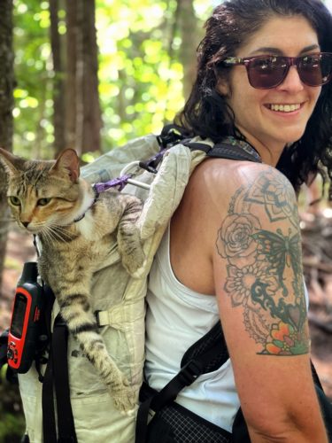
From there, Carter Dome trail made for a nice, and easy descent to Nineteen Mile Brook, where we experienced our second highlight of the day – meeting Floki, the adventure cat!
For those of you not in the know with the White Mountains hiking community, Floki is a bit of celebrity around here, as a cat who just completed the NH48 with her owner, Mel. I’ve been following their journey for over a year, so I fangirled HARD when they passed us coming down NMB. Mel was incredibly sweet, graciously allowing me to take a photo of them and chatting with us for a few minutes, along with her friend Michaela (congrats on #35, Michaela!) – and Floki is just the coolest cat around.
While I may be a sassy hiker, those who know me well know that I am a complete softy when it comes to animals, so meeting Floki was a real treat – and just the eye bleach I needed after the ball-scratching brigade! And if you’re not following their Instagram account, you really should – it is so stinking wholesome.
After that, NMB was an easy descent down, and end to a very strange (yet fun) adventure hiking the Carters: Middle Carter #37, South Carter #38, and Carter Dome #39. Just single digits left to go, but many more memories to make!
July 19, 2021
Great article, great blog. Glad you liked my instagram post. Is there a way I can follow your blog?